LEGACY SURVEYING
TOPO / BOUNDARY / ALTA
Legacy Surveying provides topographic, boundary, and ALTA surveying services to the Greenville-Spartanburg-Anderson and Greater South Carolina area.

TOPO / BOUNDARY / ALTA
Legacy Surveying provides topographic, boundary, and ALTA surveying services to the Greenville-Spartanburg-Anderson and Greater South Carolina area.
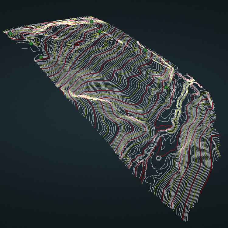
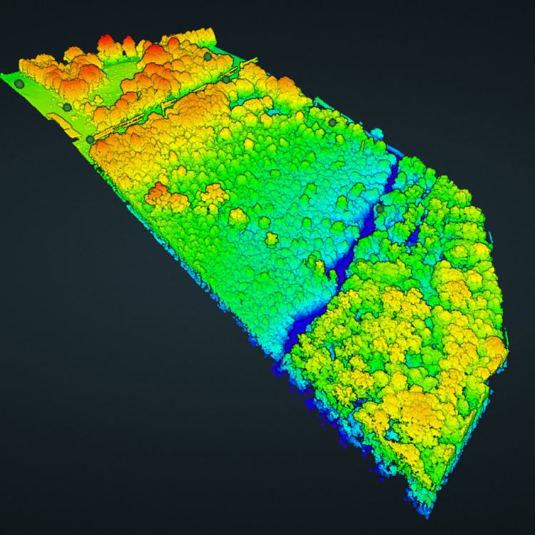
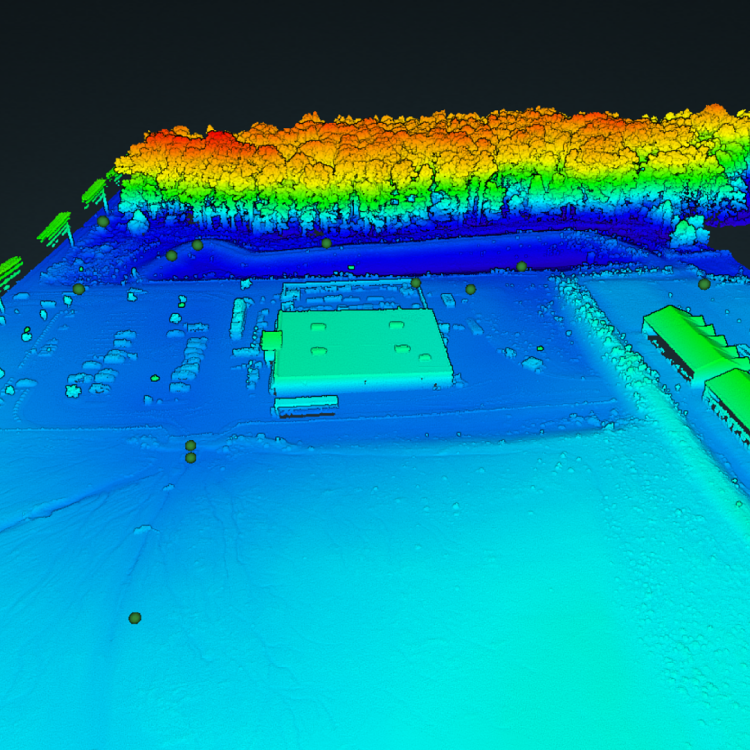
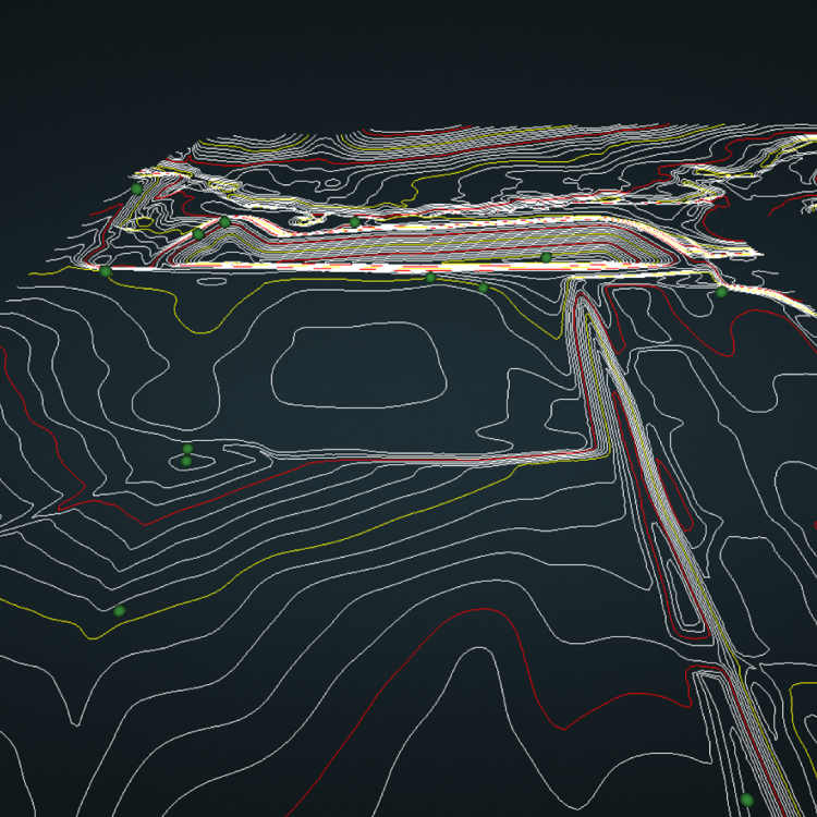
Legacy Surveying provides accurate, high-quality topographic contours in addition to precise LiDAR point cloud data. Interested in our previous work? Explore the data from past projects below.
At Legacy Surveying, our commitment is to quality and precision. Whether we’re flying a drone as part of our data collection process, producing topographic contours, or are conducting boundary surveys on foot, we have the tools, techniques, and quality assurance to provide you with the data you need for your next development.
Our data’s clean. Always. We ensure precise, accurate data collection and output through a variety of QA measures, from calibration and cleaning to a thorough review and vetting process of our data.
At Legacy, we don’t make our clients compete for attention. While other firms may take weeks or months to assess your property, our nimble structure enables our team to survey and assess your property quickly and with efficiency.
Quality is our commitment, and our customers are our first priority. At Legacy, we’re committed to working alongside you in order to deliver a quality product that suits your needs and delivers on satisfaction.
Registered Professional Land Surveyor
FAA Part 107 Licensed Commercial Drone Pilot
Liability Insurance
Equipment Insurance
Professional Insurance


Our workflow is steeped with quality checks to ensure the highest possible output and outcome, from a meticulous and measured process of reviewing, optimizing, and calibrating our equipment to thoroughgoingly vetting and scrubbing our datasets prior to delivery.
Before stepping foot onsite, we always conduct an equipment analysis, ensuring that every piece of technology we use is up-to-date and ready to capture and collect LiDAR data, ensuring accuracy of our data outputs.
Working with the latest technology, we leverage a StoneX S900A Base/Rover, allowing the StoneX and GNSS on the drone to both continually receive measurement input from satellites. We then use our base station data to correct and adjust any distortions, allowing for a complete and correct data profile.
Our pre-pro and post processes leverage the latest cloud processing tools and technologies, working hand in hand with our other quality checks to ensure accuracy of our final output.
Through accurate ground control points and proper GCP and cloud integration, we’re able to produce high-quality, highly accurate topographic contours, helping you to tackle your next commercial project.

Founding Partner & CEO
View Full Bio
A Clemson Graduate and Greenville native, Garrison is well versed in serving and supporting the Upstate and surrounding communities’ commercial needs. Garrison began his career as an analyst for a local land development firm where his long-held love of technology, hardware, and software led him to apply his expertise to the field of drones and data collection through LiDAR technology.
A licensed, FAA commercial Drone Pilot, Garrison leverages his analytical mind and technological tools to collect data and work alongside land developers to create accurate, technical, and actionable topographic surveys. With a deep understanding of industry technology, including Lidar360, LiGeorefrence, and PCMaster software Garrison and his team are committed to delivering top-of-the-line mapping and surveying for the commercial sector.

Project Manager & Professional Land Surveyor
View Full Bio
A registered Land Surveyor and Civil Designer, Daniel brings 36 years of commercial experience to the Legacy team. An expert in 3D modeling software (CADD), Daniel brings a wealth of technical expertise to the team, including a focus on Civil Design, Land Surveying, and Modeling. Through a vast array of software and hardware expertise, Daniel and the Legacy team are able to work with a variety of modeling and data input sources to meet a wide variety of client needs, matching the desired output.
An expert in the use of LiDAR for commercial design documentation, Daniel also brings years of experience with Static Scanning, Mobile Scanning, and Aerial Scanning platforms to the table, and is well versed in applying the resulting data to civil and commercial client projects.